We picked a fantastic day for skiing at Mt Seymour in the British Columbia coastal range after an overnight storm dropped some good winter snows down to a fairly low elevation.
The storm left every tree on the mountain with low freezing levels but also low cloud base led to huge amounts of rime ice that added to the quality of the winter scene. This entry is my attempt to explain the conditions that led to one of the prettier days on a mountain that I've had. First, here are some shots.
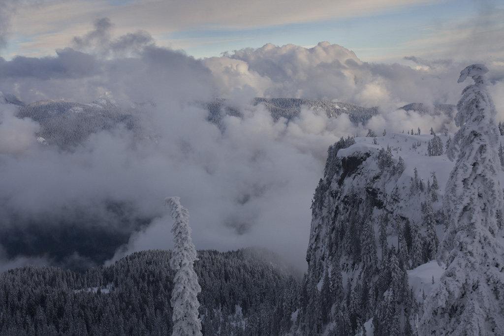
 |
| This scene was taken at 2055 UTC from the top of Mt Seymour's highest lift facing west. |
 | |
| MODIS Aqua satellite full color visible image courtesy of MODIS today. | The blue triangle is the location of Mt. Seymour. |
The low cloud cover increased just a bit to enhance the depth of the sky. In some areas they provided a backdrop to further enhance the mountains.
 |
| An image facing west from the top of Mt. Seymour at 2255 UTC. |
 |
| The Quillayute, WA sounding in black is overlaid by teh Kelowna, BC sounding in orange. My best guess sounding is in red. |
 |
| The scene east of Mt. Seymour, BC taken 2309 UTC. |
When the sun lowered further into the southwestern sky, the low clouds thinned out a little and the light warmed enough to allow me to take some shots across to Vancouver Island such as the one below.
 |
| A view across the Salish sea toward Vancouver Island taken at 2329 UTC. |
Just after this shot, I noticed a peculiar cumulus cloud over over Burnaby well south of the terrain. At first I didn't think much of it but after three chairlift rides up without seeing it dissipate, I figured there was a heat source that took advantage of the atmosphere that day to allow a semipersistent updraft to continue. Perhaps there is a power plant underneath it somewhere.
 | ||
| A shot south of Mt. Seymour of a persistent cumulus cloud that may be partially anthropegenic in nature. This shot was taken at 2353 UTC. |
What made this day special was a combination of a relatively cold precipitation event the night before that dumped a fresh layer of new snow with added riming from a low cloud base and cold temperatures. Then during the day, we had a shallow convective layer that allowed mountain cumulus to form but not so much as to flatten the lighting or obscure us in fog. The high clouds were there to add depth but not so much to destroy the contrast. I couldn't ask for a better setup considering the location.
I have more pictures at http://towerofstorms.net/gallery2/main.php?g2_itemId=4655
nice blog setup Jim!
ReplyDelete